Real events · Tropical cyclone · 26 October 2026
Cyclone Arnab review: slow landfall near Yanam, Andhra Pradesh
Arnab, the first named cyclone of the 2026 North Indian Ocean season, crossed the Andhra Pradesh and Yanam coast on 28 October and nearly stalled there. These are the figures reported so far and how they fit the history of this coast.
Key facts
- Time
- 26 October 2026, 00:00 UTC
- Peak wind
- 222 km/h
- Saffir-Simpson category
- 4
- Alert level
- GDACS: red
- Status
- active
- Coordinates
- 15.70, 82.60
- Source
- GDACS
From a Bay of Bengal low to a slow landfall
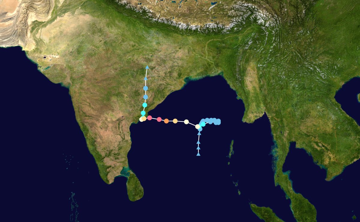
Arnab began as a low-pressure area over the east-central and adjoining south-east Bay of Bengal on the morning of 23 October 2026. The India Meteorological Department (IMD) upgraded it to a cyclonic storm in the early hours of 26 October, the first of the season, according to Down To Earth. Then it strengthened quickly. IMD said its wind speed rose by about 74 km/h within a day.
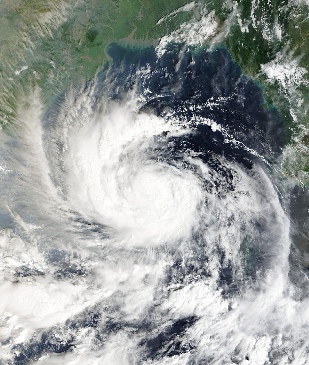
The peak came on the evening of 27 October, when IMD estimated sustained winds of 150 to 160 km/h with gusts to 180 km/h. The storm moved west-northwest toward the coast between Narsapur and Kakinada. Its swell reached far beyond the track: on 27 October waves crashed over a seawall in Chennai and a coastal highway there was temporarily closed.
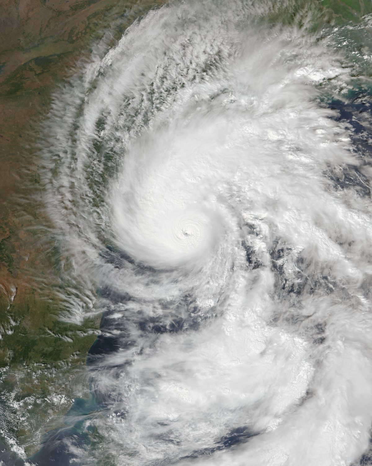
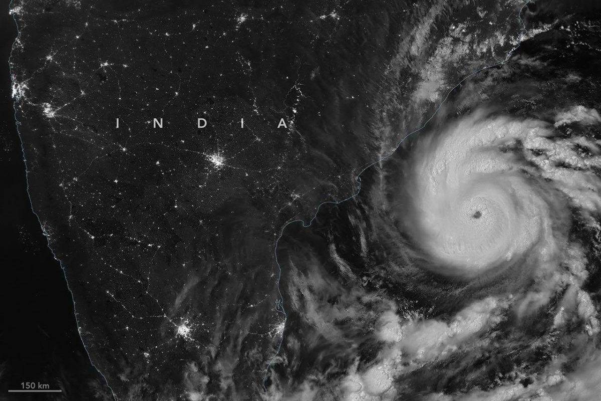
Landfall began around 01:30 IST on 28 October near Narsapur. At 05:30 IST, IMD placed the centre near 16.4°N, 82.0°E, about 45 km south-southwest of Yanam, and described it as practically stationary, as reported by The Week. The storm crossed the coast south-west of Yanam between about 02:00 and 08:30 IST, completing landfall roughly 20 km east-northeast of Narsapur. IMD put winds over the landfall area at 125 to 135 km/h, gusting to 150 km/h, and warned of a storm surge of 1.5 to 2.5 m above normal tide, according to Reuters via The Kathmandu Post.
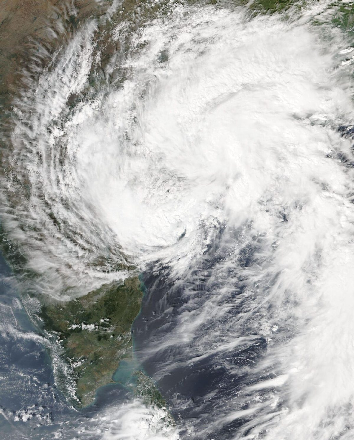
After landfall, Arnab moved only about 30 km in six hours. A storm that lingers keeps raining on the same districts, and coastal Andhra Pradesh recorded up to 263 mm. By 29 October it had weakened into a deep depression over north coastal Andhra Pradesh, south Odisha, south Chhattisgarh and northeast Telangana. On 30 October it became a depression, and its remnants brought heavy rain to south Bengal, where Sagar Island recorded 81.8 mm in the 24 hours to 08:30 IST.
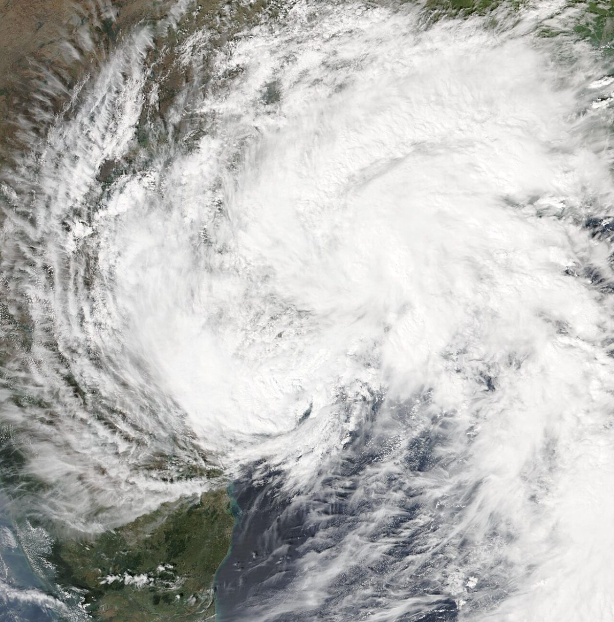
Category 4 or very severe: two ways of measuring one storm
GDACS issued a Red alert and lists Arnab at 222 km/h, Category 4. IMD never published numbers that high. Most of the gap comes from method. The US Joint Typhoon Warning Center (JTWC) uses 1-minute average winds, and its track data, shown by RainViewer, gives a peak of 222 km/h and 940 mb at 12:00 UTC on 27 October. IMD averages over 3 minutes, which yields lower values, and its lowest pressure estimate was 973 hPa. On IMD's scale Arnab was a Very Severe Cyclonic Storm, the third-highest category. The GDACS figures follow the JTWC estimate.
Using JTWC data, the weather blog Vagaries of Weather called Arnab the strongest post-monsoon Bay of Bengal cyclone since Hudhud struck Visakhapatnam in 2014. That is a blog's assessment, not an official IMD statement.
Deaths, evacuations and damage, as of 30 October
The figures are preliminary and do not agree. As of 31 October, no consolidated toll had been published by the state government, the National Disaster Management Authority or UN OCHA.
- Andhra Pradesh deaths: 3, according to NDRF official Narendra Singh Bundela on 28 October (Al Jazeera); 5, according to Chief Minister N. Chandrababu Naidu on 28 October (Xinhua); at least 7, according to the Chief Minister as reported on 30 October (The News Minute). Reported causes include electrocution and falling trees, walls and electric poles.
- Odisha deaths: at least 3, including a nine-month-old baby, in a rain-triggered landslide on 30 October, officials told PTI (ThePrint).
- Evacuations: more than 180,000 people moved in Andhra Pradesh and Odisha before landfall, as reported on 27 and 28 October. About 57,000 people were in relief camps in Andhra Pradesh on 28 October.
- Odisha floods: as of 30 October, about 50,000 people severely affected in Ganjam, 30,000 in Gajapati and 12,000 in Kandhamal, with 313 rescue teams deployed.
A combined toll of about 10 is possible but had not been confirmed by any official agency as of 31 October. No injury figures have been confirmed.
Damage was heaviest on farms and power lines. Naidu said about 15,000 electricity poles were uprooted and put preliminary losses at Rs 4,600 crore. In a letter to Union Home Minister Amit Shah, reported by The Daily Pioneer, he listed about 70,900 hectares of paddy and other crops damaged, about 10,450 hectares of horticulture crops inundated or damaged, and at least 180 houses destroyed. Another report put the affected area at 2,24,489 hectares across 14 districts, with about 3.45 lakh farmers hit. These two crop figures have not been reconciled. Coconut and banana plantations in Konaseema suffered most, and four wards of Visakhapatnam flooded.
Why this stretch of coast
India has two cyclone seasons, and late October is the post-monsoon peak. Systems forming over the warm Bay of Bengal at this time usually track west-northwest toward Andhra Pradesh and Odisha. Arnab followed that pattern closely.
Almost exactly a year earlier, on 28 October 2025, Cyclone Montha crossed the same coast near Kakinada and Narsapur. It was weaker, with sustained winds of 90 to 100 km/h. One person died in Konaseema and more than 76,000 people were moved to shelters.
The older record is far darker. The November 1977 Andhra Pradesh cyclone killed at least 10,000 people. The May 1990 cyclone killed more than 967. In November 1996 a cyclone struck about 50 km south of Kakinada and damaged 647,554 houses, and the 1999 Odisha super cyclone killed about 9,887 people by the Government of India's count. The much lower tolls of recent storms are linked to better warnings and mass evacuation. Before Arnab, Andhra Pradesh kept 2,131 cyclone shelters ready across 20 districts and turned at least 609 schools into relief centres.
What our simulator shows
HazardSim draws simple circular wind zones around a single storm position. For this event we used the GDACS point at 15.7°N, 82.6°E, dated 26 October 00:00 UTC. The zone radii were 81 km for the 119 km/h band, 36 km for 178 km/h and 26 km for 209 km/h. Our model found zero people in OpenStreetMap towns inside any of them.
That zero is not a statement about the real impact. The point sits over open water, south-east of where Arnab later came ashore, and our circles do not move along the track or shrink as the storm weakens over land. The model also ignores rain, surge and flooding, which caused much of the damage here, including the landslide in Odisha. It is a quick first look, not a forecast.
Recovery and the rain that followed
Naidu made an aerial survey of Konaseema district on 29 October, announced ex gratia payments of Rs 5 lakh to each bereaved family, and said central assessment teams would visit on 30 October. In Odisha, relief work focused on the flooded southern districts. IMD forecasts had also flagged a possible interaction between Arnab's remnants and a western disturbance, which could bring heavy rain to northern India and Nepal, as Montha's remnants did in 2025.
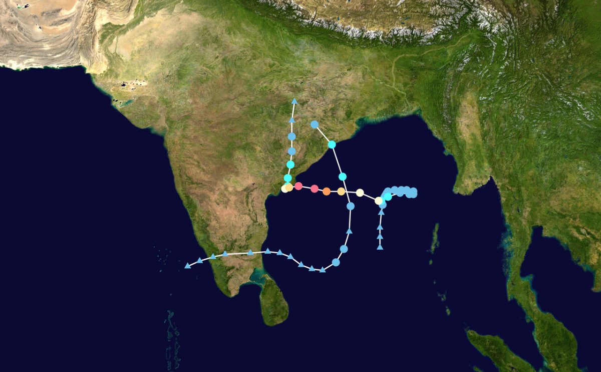
What the simulator shows
At 222 km/h the wind model puts hurricane-force winds (119 km/h and above) within about 81 km of the point on the map; no town listed in GeoNames lies inside that circle. The point is where the track first came within reach of a large city.
This is a simplified model, not a damage report. Real effects depend on soil, buildings, terrain and the details of the event.
Open in the simulatorSources
- Official data: GDACS
- GeoNames (CC BY 4.0): geonames.org
- GDACS (EC JRC / UN OCHA): GDACS Tropical Cyclone report ARNAB-26 (event 1001345, episode 10)
- Down To Earth: Cyclone Arnab's aftermath: Lives lost, heavy rainfall, and inland weakening
- The Kathmandu Post (Reuters): Cyclone Arnab begins making landfall in India's Andhra Pradesh state
- The Week: Cyclone Arnab makes landfall; heavy rains lash Andhra Pradesh, Odisha
- Al Jazeera (with AFP, Reuters): At least 3 dead after Cyclone Arnab hits southern India
- Xinhua: Cyclone Arnab death toll rises to 5 in India
- The News Minute: Cyclone Arnab impact on Andhra: Seven dead, CM Naidu estimates Rs 4600 crore loss
- ThePrint (PTI): 3 die in landslide as cyclone 'Arnab' triggers floods in Odisha, govt steps up relief operations
- The Daily Pioneer: Cyclone Arnab weakens over land; three dead in Andhra, crops hit on 70,900 hectares
- RainViewer: Cyclone Arnab Tracker
This review was compiled with AI assistance from the sources listed below and checked against official data.
More recent events
Click a point to open the event
 M6.2Magnitude 6.2 earthquake: Espiritu Santo Island, Vanuatu
 M6.4Magnitude 6.4 earthquake: Southeast Pacific Ocean
 M6.0Magnitude 6.0 earthquake: Torres Islands region, Vanuatu
 M6.1Magnitude 6.1 earthquake: Espiritu Santo Island, Vanuatu
 M6.5Magnitude 6.5 earthquake: Bonin Islands, Japan
 M6.3Magnitude 6.3 earthquake: Torres Islands, Vanuatu